(a) Population densities and distribution in rural and urban areas.
(b) The remoteness of the location and hence the stage at which centrally-supplied mains water was introduced.
(c) The subsequent removal of pumps for health/tidiness/material recycling/land re-use reasons.
(d) Patchy recording of those which remain.
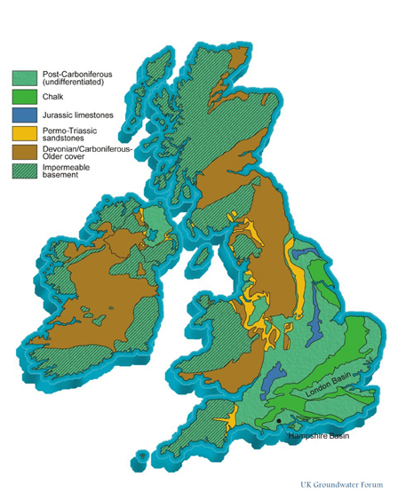
(e) And, surely primarily, the variable geology and topography across the country, which would have determined both the need for and the practicality of the sinking of wells or boreholes to reach the water table.
| Area | Pumps located to date (Dec 2014) |
| Scotland N of Firths of Clyde/Forth | 71 |
| Scotland S of Firths of Clyde/Forth | 59 |
| Cumbria | 50 |
| "Old" Yorkshire | 235 |
| "Old" Lancashire | 33 |
| Isle of Man | 1 |
| North Wales | 36 |
| Pembrokeshire/Carmarthenshire | 71 |
| Essex | 310 |
| Sussex | 95 |
| Hampshire | 32 |
| Isle of Wight | 33 |
| Cornwall | 110 |